Hurricane Tracker Screensaver
The Hurricane Tracker screensaver is a live map of active tropical cyclones — their position, strength and forecast track — from the U.S. National Hurricane Center, gathered by the pipeline. It's free, seasonal, runs in your browser, and ESC exits.
Live preview
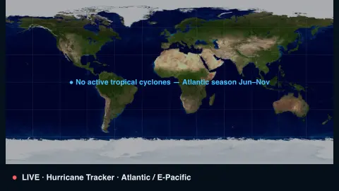
Press ESC to leave fullscreen. Settings are saved in your browser only.
How the Hurricane Tracker screensaver works
A background pipeline reads the National Hurricane Center's list of active tropical cyclones in the Atlantic and eastern Pacific.
Each storm is drawn on a world map as a spinning cyclone whose size and color reflect its strength, from tropical depression to Category 5.
Its name, classification and wind speed are labelled, with an arrow showing which way it's moving.
Hurricane season runs roughly June to November; out of season the map calmly notes that no storms are active.
How tropical cyclones are classified and named
The National Hurricane Center, part of the U.S. National Weather Service, issues official forecasts for tropical cyclones in the Atlantic and eastern North Pacific. Regular advisory packages go out every six hours, at 0300, 0900, 1500 and 2100 UTC, with intermediate advisories at 3-hour intervals when coastal watches or warnings are in effect. Storms in other basins are covered by other agencies and are not part of this feed.
Classification is based on maximum sustained winds. A tropical depression has winds of 38 mph or less, a tropical storm 39 to 73 mph, and a hurricane 74 mph or more. The Saffir-Simpson scale then rates hurricanes from Category 1 (74 to 95 mph) to Category 5 (157 mph or higher), based only on maximum sustained wind speed. It does not account for storm surge, rainfall flooding or tornadoes, which hurricanes of any category can produce.
The forecast cone represents the probable track of the storm’s center. It is built from circles sized so that two-thirds of past official forecast errors fall within them, so the center can still move outside it. The cone says nothing about storm size or intensity, and impacts extend well beyond it. The Atlantic season runs June 1 to November 30; the eastern Pacific season starts May 15. For safety decisions, use official advisories.
A worked example
During an active spell the Atlantic might show Hurricane Helene · Cat 3 · 120 kt spinning off the coast with a motion arrow, while quieter weeks simply read No active tropical cyclones — Atlantic season Jun–Nov.
Settings & tips
- Basin filters to the Atlantic, eastern Pacific, or all storms.
- Accent recolours the map highlights.
- Run
automation/run.py hurricaneon your pipeline machine to refresh storms.
Frequently asked questions
- Is the storm data real?
- Yes. It comes from the U.S. National Hurricane Center, refreshed by the pipeline, so positions and strengths are the official ones.
- Why is the map often empty?
- Tropical cyclones are seasonal. Outside the June-to-November season there are usually none, and the map says so.
- Should I rely on this for safety?
- No. It's an ambient display — always follow official forecasts and local guidance for any real decisions.
- Why does it use a pipeline?
- The Hurricane Center feed isn't readable directly from a browser, so a small background script fetches it and saves a snapshot.
- Is it free?
- Yes — free, no download, in your browser.
- What is the difference between a hurricane and a typhoon?
- They are the same kind of storm, a tropical cyclone with sustained winds of 74 mph or more, named by region. The National Hurricane Center uses hurricane for Northern Hemisphere storms east of the International Dateline to the Greenwich Meridian, and typhoon for Pacific storms north of the Equator and west of the Dateline.
- Does the Saffir-Simpson category measure flooding danger?
- No. It is based only on maximum sustained wind speed. Storm surge, rainfall flooding and tornadoes can occur with hurricanes of any category.
- What does the cone in a forecast show?
- It shows the probable track of the storm’s center, not its size or the area that will be affected. The center can move outside the cone, and hazards can occur well beyond it.