Wildfire Watch Screensaver
The Wildfire Watch screensaver lists currently open wildfires worldwide with location and start date, plus a per-continent count, drawn key-less and live from NASA's EONET open natural-events feed. It's free, runs in your browser, and ESC exits.
Live preview
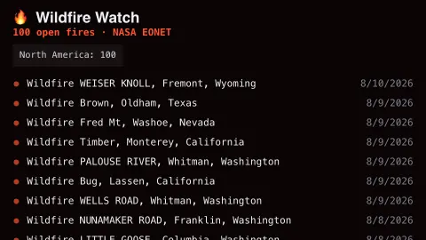
Press ESC to leave fullscreen. Settings are saved in your browser only.
How the Wildfire Watch screensaver works
The saver queries NASA EONET, filtered to the wildfires category, for every currently open event worldwide.
Each fire scrolls through as a row with its name, region and the date it was first observed.
A per-continent tally updates as the list refreshes, giving a sense of where activity is concentrated.
Optionally chime softly whenever a new fire is added to the open list.
EONET and the idea of a natural event
EONET, the Earth Observatory Natural Event Tracker, is a NASA service whose development began in 2015, supported by NASA’s Earth Science Data Systems Program and NASA Earth Observatory. It catalogues natural events such as wildfires, severe storms and volcanoes. Each event has a title, one or more categories, one or more sources, and a series of dated geometries, either points or polygons. That makes it a convenient directory of what is going on, and a poor substitute for local fire agencies.
A wildfire entry in EONET is an event record, not a measurement of burned area. Sources are references, usually the place the event was first recorded, and an event can have several; InciWeb is one example. Event extents come from multiple sources and are often approximate. An event is open until it has a closed date, and NASA’s documentation cautions that the closed value may not always reflect the true end of the event, so a fire can stay listed after it is effectively over.
The start date reflects when the event was first recorded, and the continent counts reflect how many open records exist, not how large or destructive the fires are. EONET’s own notes say the data is meant for visualization and general information, not as official spatial or temporal records. For evacuation or safety information, follow local emergency services.
A worked example
During a dry season you might see the tally lean heavily toward North America or Australia — a real snapshot of where NASA is currently tracking open fires, not a simulation.
Settings & tips
- Alert chime plays a soft tone when a new fire appears.
- Accent recolours the flame icons.
- "Open" events are ones NASA hasn't yet marked closed — containment can lag the list.
Frequently asked questions
- Is this satellite hotspot data?
- No — it's NASA EONET's curated list of named open wildfire events, not raw satellite hotspot pixel detections.
- Is a key needed?
- No. EONET's API is free and key-less.
- How current is the list?
- As current as EONET's own updates, which track ongoing major fires in near real time.
- Is it free?
- Yes — free, no download, in your browser.
- Is this the same as satellite fire hotspots?
- No. EONET lists events, each with a title, categories, sources and dated locations, rather than individual detections. Its extents are often approximate.
- Why might a fire stay on the list long after it looks over?
- An event stays open until it has a closed date, and NASA notes the closed value may not always reflect the event’s true end.
- Can I rely on this for safety decisions?
- No. EONET describes its data as meant for visualization and general information. Local fire and emergency agencies hold the current, authoritative information.