Weather Radar Screensaver
The Weather Radar screensaver loops live precipitation radar over your chosen region, animating the last hour of rain and snow across a dark map. The radar comes from RainViewer and the base map from CARTO — both free and key-less. It's free, runs in your browser, and ESC exits.
Live preview
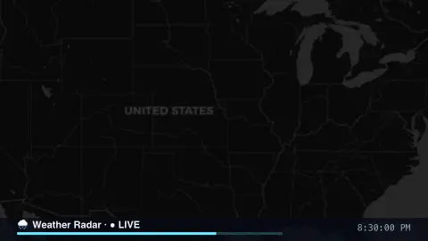
Press ESC to leave fullscreen. Settings are saved in your browser only.
How the Weather Radar screensaver works
The saver is a small slippy map. It works out which map tiles cover your region at the chosen zoom using the standard Web Mercator tile maths, then fetches and composites those square tiles into the canvas.
A dark base map comes from CARTO's free tiles. Over it, the saver overlays radar tiles from RainViewer, which publishes a list of recent radar frames — roughly the past hour plus a short nowcast forecast.
Each animation step swaps in the next radar frame, so precipitation appears to sweep and evolve across the map. A timeline at the bottom shows the loop position and the timestamp of the frame on screen.
Everything is fetched live and key-less; tiles are cached as they load, so the loop runs smoothly once it has warmed up.
How weather radar sees rain
A weather radar sends out very brief pulses of radio waves and listens for what returns from targets such as raindrops. The time each pulse takes to come back gives the distance, and the energy returned is called reflectivity. Forecasters express it in dBZ, a logarithmic unit running from about −35 to +85. Roughly, NWS guidelines treat 20 to 40 dBZ as light precipitation and 50 to 65 as heavy.
RainViewer assembles its map from radar data supplied by many original providers in many countries, so coverage and quality depend on the region. It publishes a coverage mask showing where radar data exists, and areas outside it are simply blank. The colours stand for intensity, not a measured rainfall total.
Radar has limits. The beam rises and widens with distance: NOAA’s example puts the lowest 0.5° beam about 12,000 feet above the ground at 100 miles. Far from a site, the radar therefore sees only the upper parts of storms and can miss low-level features. And a high dBZ does not always mean the heaviest rain, because returns depend on drop size; some tropical downpours show only 35 to 45 dBZ.
A worked example
Choose United States at zoom 4 and you'll see radar echoes drift west to east across the country — greens and yellows where it's raining, brighter cores in storms. Pick UK & Ireland and raise the zoom to 6 to watch fronts sweep in off the Atlantic. The last few frames are labelled 'forecast' — RainViewer's short-term nowcast.
Settings & tips
- Region centres the map; zoom sets how close in you are.
- Color scheme and radar opacity change how the precipitation looks over the map.
- Playback speed controls how fast the hour of radar loops.
Frequently asked questions
- Is the radar live?
- Yes. It loops the most recent radar frames from RainViewer — roughly the past hour plus a short nowcast — and refreshes for new frames every few minutes.
- Which regions can I watch?
- Eight presets are built in, including the United States, Europe, the UK, Japan and Australia. Pick one and adjust the zoom to taste.
- Why are the last frames labelled 'forecast'?
- RainViewer includes a short-term nowcast — a model projection of the next several minutes — after the observed frames, so the very end of the loop is a forecast.
- Does it need an internet connection?
- Yes, it streams live map and radar tiles. Offline it shows a short notice instead.
- Is the weather radar screensaver free?
- Yes, free and browser-based with no key or download. Run it fullscreen and press ESC to exit.
- Why are there blank areas on the map?
- RainViewer publishes a coverage mask showing where it has radar data, and places outside it are blank. Far from any radar the beam is also high above the ground, so low-level rain can be missed.
- Does a brighter colour always mean heavier rain?
- Not always. Radar measures reflectivity, which depends on drop size as well as rainfall, so very heavy tropical rain can return only moderate values. Treat the colours as intensity, not a measured rainfall total.
- Why can rain far from a radar look weak or missing?
- The beam climbs as it travels away from the site, so at long range it passes over the lower part of a storm and may catch only the top of the cloud.