Two Centimetres Per Pixel Screensaver
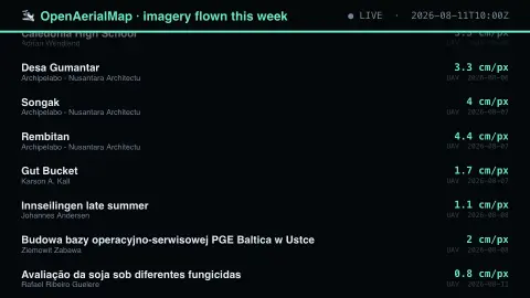
The Two Centimetres Per Pixel screensaver shows open drone and aircraft imagery flown in the last few days, key-less from OpenAerialMap. Ground sample distance is the number that matters: satellite imagery is measured in metres per pixel and these are measured in centimetres, because someone flew a drone a hundred metres up. After a flood or an earthquake, local imagery at this resolution arrives days before anything else. It's free, runs in your browser, and ESC exits.
Live preview
Press ESC to leave fullscreen. Settings are saved in your browser only.
How the Two Centimetres Per Pixel screensaver works
The saver reads the source described above and draws it on a canvas — no account, no tracking.
Open drone and aircraft imagery flown in the last few days, key-less from OpenAerialMap. Ground sample distance is the number that matters: satellite imagery is measured in metres per pixel and these are measured in centimetres, because someone flew a drone a hundred metres up. After a flood or an earthquake, local imagery at this resolution arrives days before anything else.
It refreshes on a schedule, so what you see stays current.
Colours can be changed in settings; nothing is stored beyond your own browser.
OpenAerialMap and ground sample distance
OpenAerialMap is a set of tools for searching, sharing and using openly licensed satellite and drone imagery, built on the Open Imagery Network. Its about page credits a community of organisations that includes the Humanitarian OpenStreetMap Team, Development Seed and others, and says imagery is licensed CC BY 4.0 with attribution to contributors and can be traced in OpenStreetMap. Its stated aim is to make imagery easier to find and use for humanitarian response and disaster preparedness.
Ground sample distance, abbreviated GSD, is the real-world length that one pixel covers. A 5 cm GSD means each pixel spans five centimetres of ground, while a 30 cm GSD spans thirty, so a smaller number resolves finer detail. GSD depends on the camera and sensor and on flying height, which is why imagery from a low-flying drone can be far sharper than most satellite pictures.
The title of each item is whatever the contributor entered, so it may be a place name in any script, a project code or an event name. Coverage is uneven: it follows where contributors chose to fly or share imagery, not a systematic survey of the world.
A worked example
Open drone and aircraft imagery flown in the last few days, key-less from OpenAerialMap. Ground sample distance is the number that matters: satellite imagery is measured in metres per pixel and these are measured in centimetres, because someone flew a drone a hundred metres up. After a flood or an earthquake, local imagery at this resolution arrives days before anything else.
Settings & tips
- Accent and Background recolour the display.
- Every value on screen comes from the live source — nothing is simulated.
- Press ESC to leave fullscreen.
Frequently asked questions
- Is this real data?
- Yes — it comes from the source named on this page and is refreshed on a schedule.
- Is a key needed?
- No. This source is fully key-less.
- Is it free?
- Yes, and it runs entirely in your browser.
- What does a lower GSD number mean?
- Smaller numbers mean sharper images. Two centimetres per pixel resolves far more detail than thirty, though a given scene then needs more pixels.
- Is every image from a disaster?
- No. OpenAerialMap was built with humanitarian response in mind, but it is an open collection of aerial imagery and its contents are not limited to emergencies.
- What licence is the imagery under?
- The OpenAerialMap about page says imagery is licensed CC BY 4.0, which requires attribution to the contributors. Check an image's own metadata for its terms.