Migratory Whale Routes Screensaver
The Migratory Whale Routes screensaver maps the world's major real whale migration routes between feeding and breeding grounds. It is free, runs in your browser, and ESC exits.
Live preview
Press ESC to leave fullscreen. Settings are saved in your browser only.
How the Migratory Whale Routes screensaver works
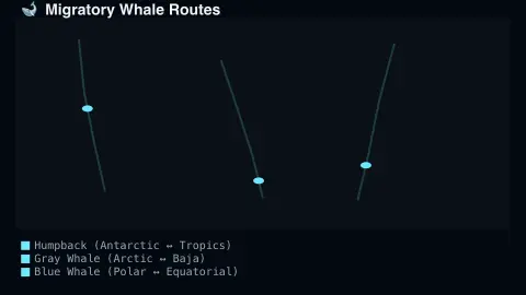
The saver draws a world map overlaid with the real major migration routes of humpback, gray and blue whales.
Animated markers travel each real route between documented feeding and breeding grounds.
The map is a real, curated reference of well-documented migration research.
No live feed is required — major migration routes are stable, real, well-studied patterns.
Why whales migrate, and how routes are known
Many large whales split the year between cold, productive high-latitude feeding grounds and warmer breeding grounds, covering thousands of kilometres between them. Humpbacks, for example, feed on krill and small fish in the warmer months and build up blubber stores that sustain them through the winter, while breeding and calving happen in warm, often shallow waters near reefs or shores.
Humpbacks are the classic example. NOAA describes separate populations in the North Pacific, North Atlantic and Southern Hemisphere, each linking particular feeding areas with particular breeding areas, and some swim about 5,000 miles between them. Eastern North Pacific gray whales make one of the longest annual migrations of any mammal, roughly 10,000 miles round trip, from summer feeding in the Bering and Chukchi seas to winter calving in the lagoons and bays of Baja California, Mexico.
Researchers piece routes together from photographs of individually recognisable animals (fluke patterns and scars act like fingerprints), satellite and other tags, and shipboard and aerial surveys. A line on a map is a simplification of a broad, variable corridor, and individual animals can deviate. The map is a reference picture, not a tracker of animals at sea.
A worked example
A marker travels the real documented humpback route from Antarctic feeding grounds toward tropical breeding waters, exactly matching published migration research.
Settings & tips
- Accent recolours the migration markers.
- Routes shown are real, well-documented migration corridors.
- Some of the longest real migrations of any mammal.
Frequently asked questions
- Are these real migration routes?
- Yes — all routes shown are real, well-documented whale migration corridors.
- Is a key needed?
- No — the map is a curated real reference.
- Does this track live whales?
- No — it shows real documented migration corridors, not individual live tracking.
- Is it free?
- Yes — free, no download, in your browser.
- Why do whales migrate?
- Many species travel to cold, productive waters to feed and to warm, often shallow waters to breed and calve, building up blubber while they feed.
- Do all whales of one species follow the same route?
- No. Species split into populations that use different feeding and breeding areas, and individuals vary, so a route on a map is a simplification of a broad corridor.
- How do scientists track whale migrations?
- They combine photo-identification of individuals, tagging, and shipboard and aerial surveys, along with genetic analysis, to reconstruct movements.