UK Street Crime Screensaver
The UK Street Crime screensaver shows real street-level crimes reported to police across England, Wales and Northern Ireland, from the key-less data.police.uk API. The police only ever publish an approximated 'on or near' street and no personal detail. It's free, runs in your browser, and ESC exits.
Live preview
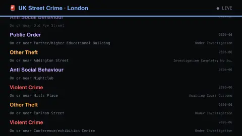
Press ESC to leave fullscreen. Settings are saved in your browser only.
How the UK Street Crime screensaver works
The saver reads data.police.uk directly in your browser — no key and no account.
Real street-level crimes reported to police across England, Wales and Northern Ireland, from the key-less data.police.uk API.
It refreshes on a schedule, so what you see stays current.
Colours can be changed in settings; nothing is stored beyond your own browser.
How police.uk publishes street-level crime
The data.police.uk service publishes open crime data for England, Wales and Northern Ireland. It comes from the 43 geographic police forces of England and Wales, the British Transport Police and the Police Service of Northern Ireland. Data are published monthly, and crimes are grouped into 14 categories based on Home Office offence codes.
To protect privacy, the locations are not exact. Each crime is snapped to the nearest of a master list of anonymous map points, each placed over a street centre, public place or commercial premises and each with a catchment of at least eight postal addresses. A mark on a street therefore means a crime was recorded near there, not at a particular house. Outcome data, such as a caution, are published separately, and the British Transport Police and Police Service of Northern Ireland do not provide them.
These are crimes recorded by police, so they reflect what is reported and how forces record it, which differs between areas and changes over time. Each release is a monthly snapshot, so the latest crimes are from a previous month, and later reclassifications are usually not picked up. A count for an area also depends on how busy it is, since the figures are not adjusted for footfall. The numbers say nothing about any individual and are not a safety rating.
A worked example
Real street-level crimes reported to police across England, Wales and Northern Ireland, from the key-less data.police.uk API. The police only ever publish an approximated 'on or near' street and no personal detail.
Settings & tips
- Accent and Background recolour the display.
- Data comes straight from data.police.uk in your browser.
- Press ESC to leave fullscreen.
Frequently asked questions
- Is this real data?
- Yes — it comes from data.police.uk and is refreshed on a schedule.
- Does this show where someone lives?
- No. The police publish an approximated “on or near” street rather than an address, and no victim or suspect detail is in the feed at all.
- Is a key needed?
- No. This source is fully key-less.
- Is it free?
- Yes — free, no download, in your browser.
- Why are the locations approximate?
- To protect privacy, each crime is mapped to the nearest of a list of anonymous points, each over a street, public place or commercial premises with a catchment of at least eight postal addresses, rather than to an exact address.
- How recent are the crimes shown?
- Data are published monthly as snapshots, so the latest data are typically from a previous month and not from the last few days.
- Does a high count mean an area is dangerous?
- Not necessarily. Counts depend on how busy a place is, reporting habits and recording practice, so a busy area can generate more records without implying higher risk to residents.