Meteorite Falls Map Screensaver
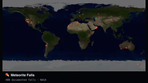
The Meteorite Falls Map screensaver plots real, documented meteorite falls and finds throughout history on a world map, coloured by era, drawn key-less from NASA's open meteorite-landings dataset. It's free, runs in your browser, and ESC exits.
Live preview
Press ESC to leave fullscreen. Settings are saved in your browser only.
How the Meteorite Falls Map screensaver works
The saver loads NASA's public meteorite-landings dataset, with no key required.
Each recorded fall or find plots at its real documented coordinates, coloured by era.
A slow rotation cycles the view across the dataset so different regions surface over time.
Filter to the last 25 or 100 years to focus on more recently documented events.
Falls, finds and the Meteoritical Bulletin
The Meteoritical Society’s Meteoritical Bulletin Database is the register of meteorite names, whose approval is handled by the Society’s Nomenclature Committee. NASA’s Meteorite Landings dataset is built from data provided by the Meteoritical Society. Each row gives a name, a classification, a mass in grams, a year and coordinates, and flags whether the meteorite fell or was found.
Two terms matter on the display. A fall is a meteorite collected after it was seen or recorded arriving, by people or automated devices. Any other meteorite is a find, a rock recognised later with no witnessed event. Most entries in the dataset are finds, because observed falls make up only a small fraction of the roughly 34,500 rows. Falls are valuable to science because they have not been exposed to weathering on the ground. A classification such as H5 or L6 describes the type of meteorite.
Apparent patterns therefore say more about where people search than where meteorites land. Some regions yield many finds because meteorites are easier to spot and to preserve there, while in others they go unnoticed. The year recorded is generally the year of fall or discovery and may be uncertain for older finds, and some entries have missing or approximate coordinates, so a few dots may sit in slightly the wrong place.
A worked example
Switch to Last 100 years and the map thins to modern, precisely documented falls — including well-known ones like the Chelyabinsk event — each a real recorded landing.
Settings & tips
- Era filter narrows the map to more recent, better-documented falls.
- Accent recolours the newest era's markers.
- Older records can have less precise coordinates — a real limitation of historical documentation.
Frequently asked questions
- Is this live meteor tracking?
- No — it's a real historical dataset of documented meteorite falls and finds, not a live sky-watch feed.
- Is a key needed?
- No. NASA's open dataset is free and key-less.
- How far back does the data go?
- Some records date back centuries; recent decades have far more precise documentation.
- Is it free?
- Yes — free, no download, in your browser.
- Why are finds concentrated in some regions?
- Meteorites fall all over the planet, but they are far easier to spot and preserve in some places than in others, so finds reflect where people search as much as where rocks land.
- What do codes like L6 or H5 mean?
- They classify chondrites. The letter is the group (such as H, L or LL, which differ in iron content), and the number is the petrologic type, which reflects how much the rock has been heated or altered.
- How is a fall different from a find?
- A fall was seen or recorded arriving and then collected. Any other meteorite is called a find.